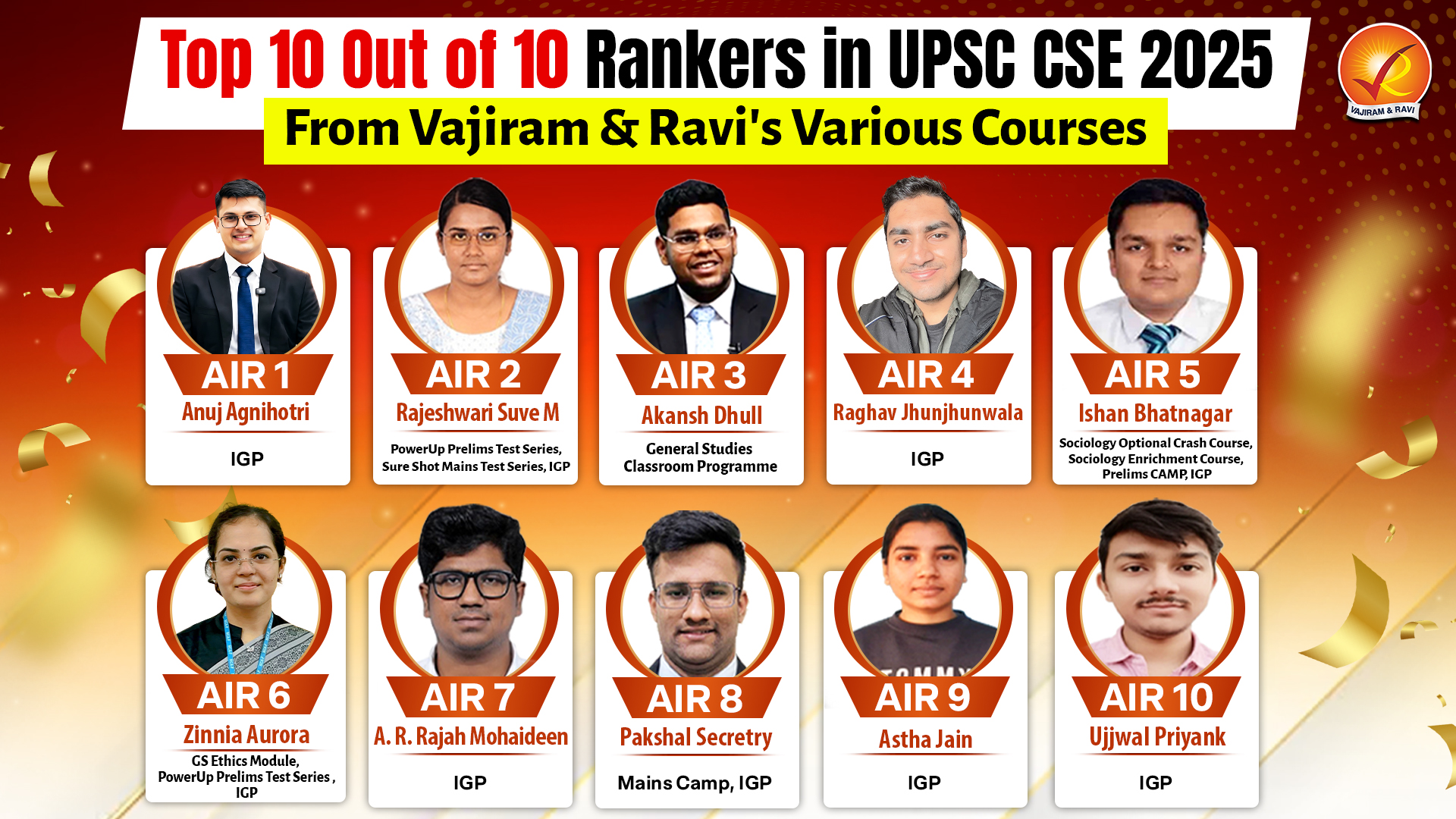
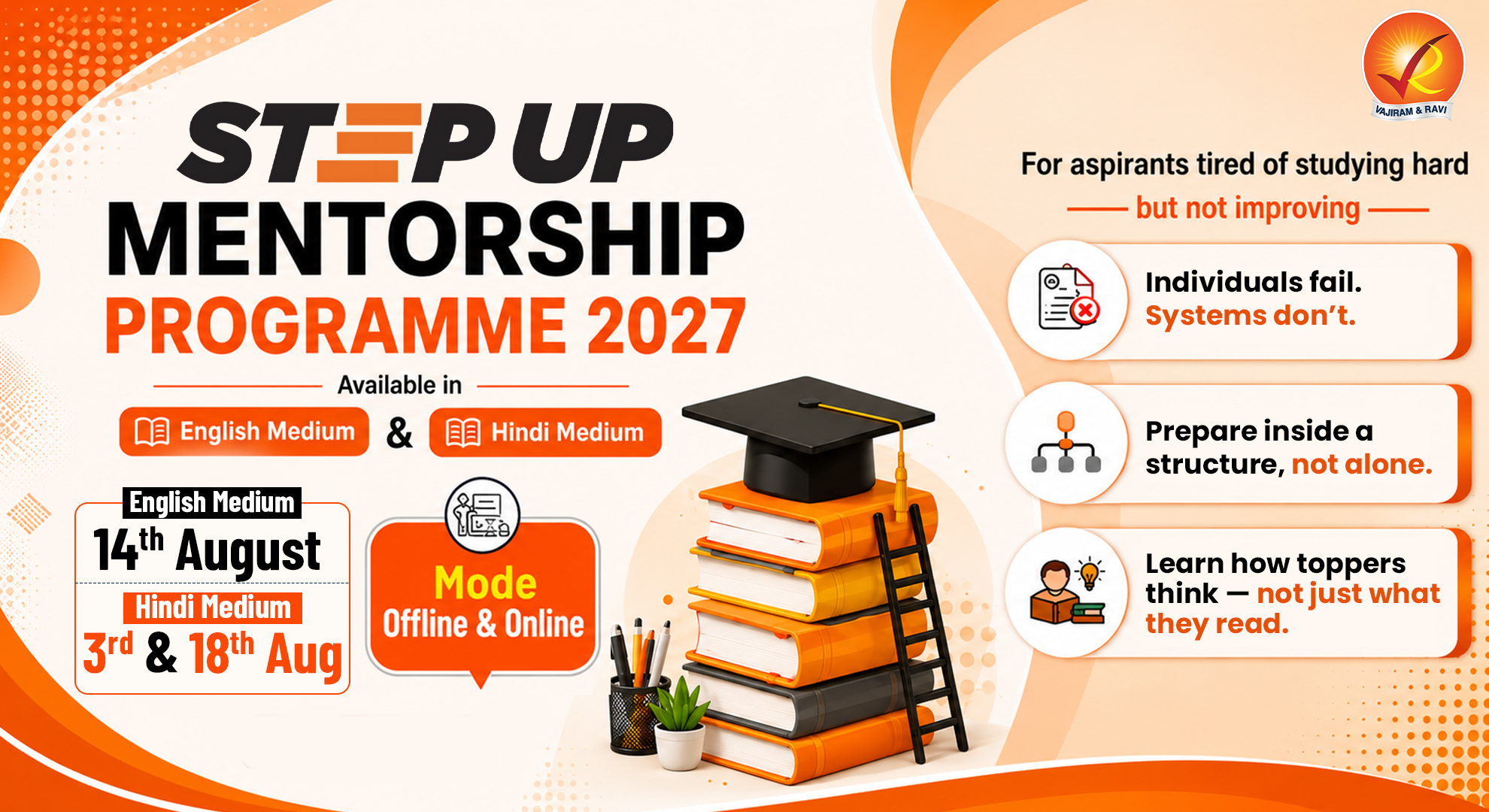
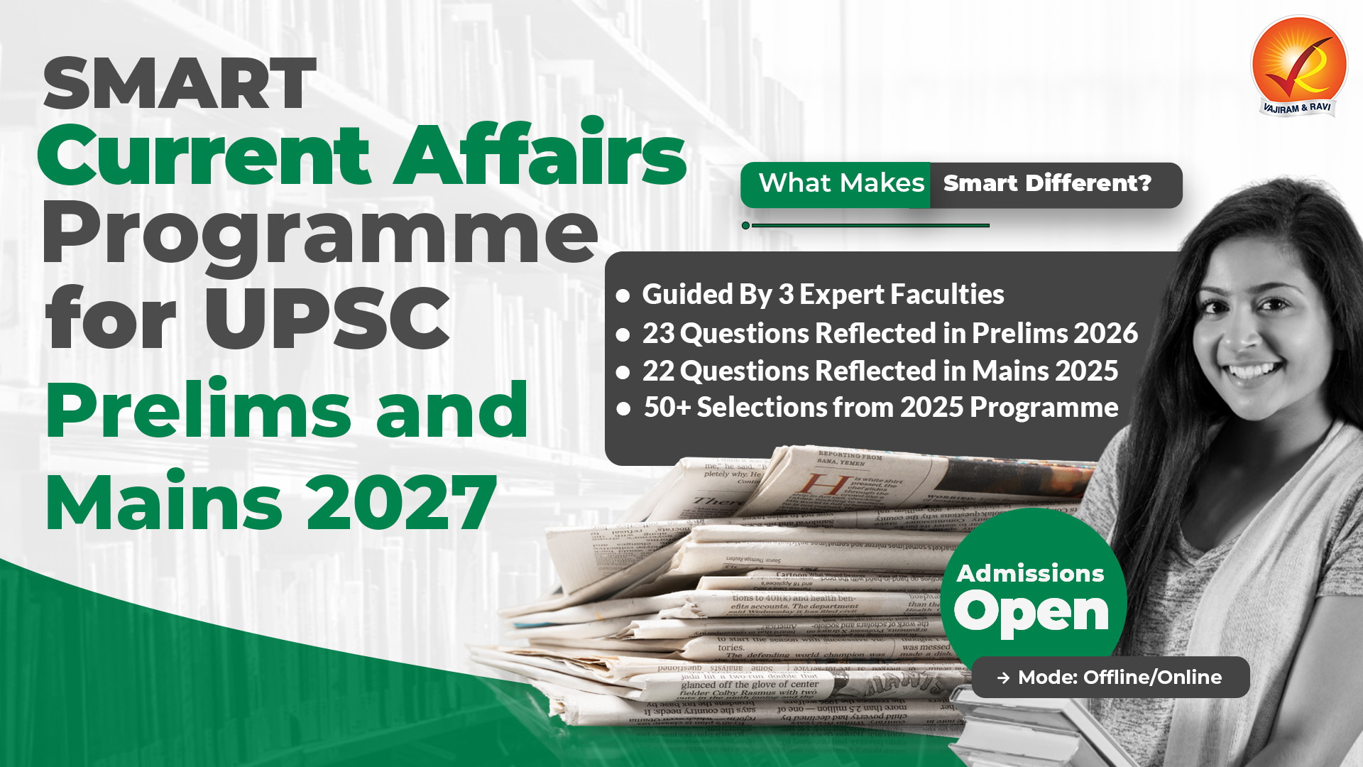
Upcoming Mentoring Sessions
RMS - World History & Post-Independence
RMS - Human & Economic Geography
RMS - Indian Society - Part II
RMS - Indian Society - Part I
News Reading Hour
RMS - Disaster Management
RMS - Environment
RMS - Internal Security - Part II
RMS - Internal Security - Part I
RMS - Social Justice - Part III
RMS - Social Justice - Part II
RMS - Social Justice - Part I
RMS - International Relations
RMS - Governance - Part II
RMS - Governance - Part I
Mentorship Program Introductory Session
RMS - Indian Physiography - Archipelagos of India
RMS - Indian Physiography - Coastal Plains of India
RMS - Art & Culture - Bhakti Movement
RMS - Polity - Elections & Political Parties
RMS - Indian Physiography - The Great Indian Desert
Step-Up RMS - Economic Survey and Budget : Part - 2
Step-Up RMS - Resources - Forests, Soils, Minerals etc : Part - 2
Step-Up RMS - Environment and Biodiversity Current Affairs : Part - 2
Step-Up RMS - History : 1935 - Independence
Step-Up RMS - Science and Technology Current affairs - Part - 2
Step-Up RMS - History : 1921 - 1935
RMS - A&C - Current Affairs
RMS - Indian Physiography - Peninsular Plateau
RMS - Polity - Services under the Union and the States & Pressure Groups
RMS - Economy - Balance of Payments
RMS - Economy - Trade & Important Government Schemes
RMS - Modern History - 1830 AD to 1857 AD
RMS - Economy - Fiscal Policy & Budgeting
RMS - Economy - Inflation
RMS - Polity - Local-Self Government & Co-Operative Societies
Step-Up RMS - Environment and Biodiversity Current Affairs : Part - 1
Step-Up RMS - Science and Technology Current affairs - Part - 1
Step-Up RMS -History : 1906 - 1920
Step-Up RMS - History 1857-1905
Step-Up RMS - Geomorphology - Types and Distribution
Step-Up RMS - Evolution + Interior of earth + oceanography
Step-Up RMS - History - Constitutional reforms
Step-Up RMS - Medieval History - kingdom chronology + terminology (Part - 2)
RMS - Indian Physiography - The Great North Indian Plain
RMS - Indian Physiography - Intro & The Himalayas
Step-Up RMS - Indian geography - location , landforms
Step-Up RMS - Drainage system + Rivers (India and world)
RMS - Art & Culture - South India
RMS - Economy - Taxation
RMS - Economy - Money and Banking - Part II
RMS - Polity - Union Legislature - Part III
Step-Up RMS – Indian Culture: Architecture + Literature (Part-2)
Step-Up RMS - Human geography
Step-Up RMS - Delhi sultanate + mughal administration
Step-Up RMS - Resources - Forests, Soils, Minerals etc
Step-Up RMS - Climatology + Indian monsoon
Step-Up RMS - Medieval History - kingdom chronology + terminology
Step-Up RMS - Indian school of philosophy -Buddhism & Jainism
Step-Up RMS - Indian Culture : Architecture + literature
Step-Up RMS - Ancient history - chronology + terminology
Step-Up RMS - Economic Survey and Budget
Step-Up RMS - Polity - Miscl-Imp Judgements , Amendments, Miscl concepts etc
Step-Up RMS - Agriculture and related concepts
Step-Up RMS - Polity - Constitutional and Non-Constitutional Bodies
Step-Up RMS - Economics - External Sector
Step-Up RMS - Polity - Judiciary- SC/HC/Lower courts
Step-Up RMS - Economics - Fiscal policy and Financial Markets
Step-Up RMS - Polity - Parliament and State Legislature
Step-Up RMS - Economics - Money and Banking
Step-Up RMS - Polity - Union and State Executives
Step-Up RMS - Economics - Basic Economics and Terminology
Step-Up RMS - Polity - State, Citizenship, FR/FD and Emergency Provisions
RMS - Polity - Judiciary - Part II
RMS - Geography - Biomes and Natural Resources
RMS - Economy - Money and Banking - Part I
RMS - Geography - Oceanography
RMS - Medieval History - 646 AD to 1192 AD
RMS - Art & Culture - Post Mauryan Period
RMS - Polity - Union Legislature - Part II
RMS - Economy - Financial Markets
RMS - Polity - Judiciary Part I
RMS - Polity - Separation of Powers & Federal System
RMS - Geography - Atmospheric Circulation
RMS - Polity - Union Legislature - Part I
RMS - Geography - Air Mass, Fronts & Cyclones
RMS - A&C - Pre-Historic to Mauryan Period
RMS - Economy - Fundamentals of Economy & NIA
RMS - Polity - Emergency Provisions
RMS - Geography - Humidity, Clouds & Precipitation
RMS - Economy - Demography, Poverty & Employment
RMS - Modern History - 1813 AD to 1857 AD
RMS - Polity - Union & State Executive
RMS - Modern History - 1932 AD to 1947 AD
RMS - Geography - Basics of Atmosphere
RMS - Polity - Fundamental Rights - Part III
RMS - Economy - Planning and Mobilisation of Resources
RMS - Modern History - 1919 AD to 1932 AD
RMS - Modern History - 1757 AD to 1813 AD
RMS - Economy - Financial Organisations
RMS - Geography - Major Landforms
RMS - Polity - Constitutional and Statutory Bodies
RMS - Geography - EQ, Faulting and Fracture
RMS - Polity - Fundamental Rights - Part II
RMS - Economy - Industry, Infrastructure & Investment Models
RMS - Polity - DPSP & FD
RMS - Economy - Indian Agriculture - Part II
RMS - Geography - Rocks & Volcanoes and its landforms
RMS - Geography - Evolution of Oceans & Continents
RMS - Polity - Fundamental Rights - Part I
RMS - Modern History - 1498 AD to 1757 AD
RMS - Modern History - 1858 AD to 1919 AD
RMS - Geography - Interior of the Earth & Geomorphic Processes
RMS - Geography - Universe and Earth and Basic concepts on Earth
RMS - Economy - Indian Agriculture - Part I
RMS - Economy - Fundamentals of the Indian Economy
RMS - Polity - Union & its territories and Citizenship
RMS - Polity - Constitution & its Salient Features and Preamble
Learning Support Session - ANSWER writing MASTER Session
Learning Support Session - How to Read Newspaper?
Mastering Art of writing Ethics Answers
Mastering Art of Writing Social Issues Answers
Answer Review Session
UPSC CSE 2026 Form Filling Doubt Session
Mentoring Session (2024 - 25) - How to Write an ESSAY?
Social Issues Doubts and Mentoring Session
Ethics & Essay Doubts and Mentoring Session
Geography & Environment Doubts and Mentoring Session
History Doubts and Mentoring Session
Economy & Agriculture Doubts and Mentoring Session
Online Orientation Session
LIVE NEWSPAPER READING SESSION
Mains Support Programme 2026-27
Mains Support Programme 2025- (1)
Polity & International Relations Doubts and Mentoring Session
Mentoring Sessions (2024-25) - How to DO REVISION?
Learning Support Session - How to Start Preparation?
RMS - Geography - World Mapping
Mentoring Session (2024-25) - How to Make Notes?
General Mentoring Session (GMS )
Mentoring Session (2025-26) - How to write an Answer?


Current Affairs
Aug. 3, 2026
What is Leptospirosis?
Leptospirosis, which began to be reported in Kerala since 1989, has been endemic in the State for the past three decades or more and has now become the communicable disease with the highest mortality profile
About Leptospirosis:
- It is a flu-like bacterial disease that affects both humans and animals.
- It is caused by the bacterium Leptospira that can be found in contaminated water or soil.
- It is a zoonotic disease. This means it’s transmitted between animals and humans.
- Transmission:
- Contact with water or soil containing urine or body fluids from infected animals, especially after hurricanes, flooding, or heavy rainfall.
- Directly touching body fluids from an infected animal.
- Eating food or drinking water contaminated by the urine of an infected animal.
- The bacteria enter the body through cuts or abrasions on the skin or through the mucous membranes of the mouth, nose, and eyes.
- Person-to-person transmission is rare.
- High Risk Groups:
- Leptospirosis has a global distribution but is most common in tropical and subtropical regions, where warm temperatures, high humidity, and heavy rainfall favor the survival of Leptospira bacteria.
- People who work outdoors, such as those engaged in hiking, gardening, outdoor cleaning and maintenance, or handling animals, as well as people who participate in outdoor water sports like swimming or wading in contaminated lakes and rivers, are at higher risks of the disease.
- Symptoms:
- Common symptoms include high fever, severe headache, chills, muscle aches, and vomiting.
- Other symptoms, including jaundice, red eyes, abdominal pain, diarrhoea, or rash, may also occur.
- Without treatment, leptospirosis in people can lead to kidney damage, meningitis (inflammation of the membrane around the brain and spinal cord), liver failure, trouble breathing, and even death.
- Treatment:
- It is treated with antibiotics, such as doxycycline or penicillin.
- Intravenous (IV) antibiotics may be needed for people who have more severe leptospirosis symptoms.
Science & Tech
Current Affairs
Aug. 3, 2026
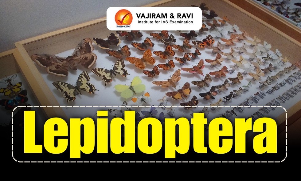
What is Lepidoptera?
Scientists of the Zoological Survey of India (ZSI) have come out with a detailed Catalogue of Lepidoptera (Butterflies & Moths) of India recently.
About Lepidoptera:
- It is an insect order comprising species of butterflies and moths.
- This order of insects is second in size only to Coleoptera, the beetles.
- The name ‘’Lepidoptera’’ is derived from the Greek, meaning “scaly winged,” and refers to the characteristic covering of microscopic dustlike scales on the wings.
- With the exception of a few moths, all adult lepidopterans have two pairs of wings.
- Because of their day-flying habits and bright colors, the butterflies are more familiar than the chiefly night-flying and dull-colored moths, but the latter are far more varied and abundant.
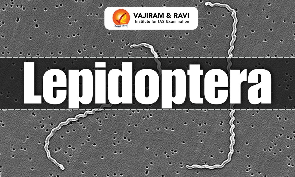
- Distribution:
- Lepidopterans live on every continent except Antarctica.
- Though they are far more numerous and diversified in the tropics, some species survive at the limits of polar vegetation.
- The life cycle of lepidopterans consists of four stages: egg, larva (caterpillar), pupa, and adult.
- They are mostly herbivorous (folivorous) as caterpillars and nectarivorous as adults.
- They play an important role in the natural ecosystem as pollinators and serve as primary consumers in the food chain.
- Conversely, their larvae (caterpillars) are considered very problematic to vegetation in agriculture, as they consume large quantities of plant matter (mostly foliage) to sustain growth.
- Silkworm (Bombyx mori), a moth, is the source of commercial silk.
Catalogue of Lepidoptera (Butterflies & Moths) of India:
- India is home to 13,703 species of lepidoptera, which is about 25% of the total lepidoptera found across the globe.
- Of the 13,703 species of lepidoptera, 1,417 are butterflies, and the remaining 12,286 are moths.
- Among the 13,703 species of lepidoptera, the scientists have identified and catalogued 2,205 species of Geometroidea, nocturnal pollinators taking over the “night shift” when daytime butterflies rest.
- These 2,205 species account for 8% of the world’s known species in this superfamily.
Environment
Current Affairs
Aug. 3, 2026
Amboseli National Park
Wildlife authorities in Kenya have launched an investigation after 15 elephants died over the past month in Amboseli National Park, with preliminary tests detecting a potential toxic substance in samples collected from the animals.
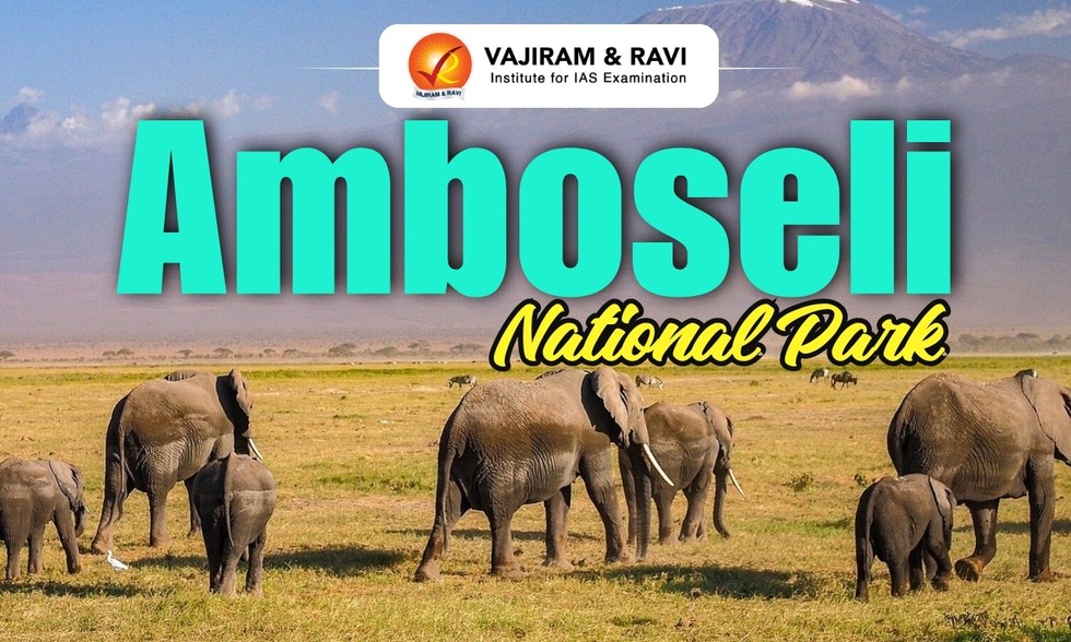
About Amboseli National Park:
- It is located in southern Kenya near the border with Tanzania.
- The name ‘’Amboseli’’ comes from the Maasai (nomadic pastoralists of East Africa) word "Empusel," which means "salty, dusty place."
- It covers approximately 392 sq.km.
- Though relatively small in size, the park is part of a much larger ecosystem that extends across the Kenya–Tanzania border, linking with protected areas surrounding Mount Kilimanjaro.
- Mount Kilimanjaro, Africa’s highest peak, rises dramatically just beyond the park’s boundary and provides one of the most recognizable backdrops in all of Africa.
- Amboseli is best known for its large herds of free-ranging African elephants.
- The geography of Amboseli is defined by a mix of dry lakebeds, open savannas, acacia woodlands, and lush wetlands fed by underground water flowing from the melting snow of Mount Kilimanjaro.
- The remnants of an ancient lake basin form the park’s central plains, which can appear dusty and arid for much of the year.
- Biodiversity:
- In addition to its famous elephants, the park is home to lions, cheetahs, hyenas, and a variety of herbivores including zebras, wildebeest, buffalo, and giraffes.
- The wetlands attract numerous bird species, making Amboseli an important site for birdwatching, with flamingos, pelicans, and many migratory birds frequently observed.
- The Amboseli ecosystem was officially designated a UNESCO Biosphere Reserve in 1991.
Environment
Current Affairs
Aug. 3, 2026
What is PowerBank-50?
Hyderabad-based space startup TakeMe2Space recently announced that its PowerBank-50 satellite battery pack has now earned the ‘flight heritage’ tag.
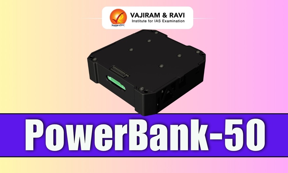
About PowerBank-50:
- It is an indigenously built satellite battery pack developed by Hyderabad-based spacetech startup TakeMe2Space.
- It is India's first indigenously developed satellite battery to earn the coveted 'flight heritage' status.
- The recognition comes after the battery pack has successfully completed its first mission aboard Skyroot Aerospace's Vikram-1 on its maiden flight -- Mission 'Aagaman'.
- Vikram-1 became the first privately developed Indian rocket to reach orbit, making India only the third country in the world, after the United States and China, where a private company has achieved orbital launch capability.
- A PowerBank-50 unit powered Cosmoserve Space’s experimental payload aboard the rocket’s Orbital Adjustment Module (OAM) at an altitude of 450 km.
- The battery performed as designed throughout launch and in the harsh conditions of space, including vacuum, radiation, and extreme temperature
- PowerBank-50 Features:
- It is a compact lithium-ion battery pack designed specifically for small satellites.
- It stores over 50 Wh of energy and is equipped with an intelligent battery management system, onboard heaters, and an aluminium flight enclosure.
- Multiple PowerBank-50 units can be stacked together to power CubeSats and microsatellites, with an operational life of up to five years in low-Earth orbit.
Why ‘flight heritage’ Matter?
- In the satellite industry, ‘flight heritage’ is the hardest credential to earn.
- Satellite builders, launch providers, and insurers are deeply reluctant to fly components that have never flown, because a single subsystem failure can end a multi-crore mission.
- This creates a well-known barrier for new suppliers: you cannot get ‘heritage’ without flying, and you cannot fly without that tag.
- The bar is highest of all for batteries that are among the most safety scrutinised components on any rocket.
- Batteries must survive intense launch vibration and shock, then operate reliably in vacuum through extreme hot and cold cycles every orbit.
Science & Tech
Current Affairs
Aug. 3, 2026
Ujh Multipurpose Project
The Union Minister of State for Prime Minister’s Office recently reviewed the status and phased implementation roadmap of the Ujh Multipurpose Project in the Kathua district of Jammu and Kashmir.
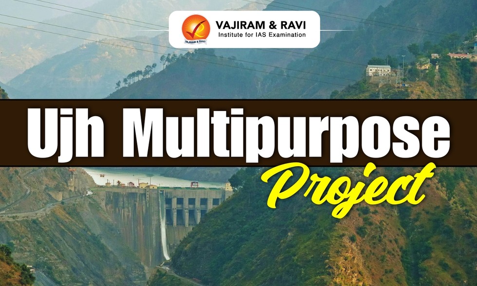
About Ujh Multipurpose Project:
- It is a multipurpose (Hydropower, Irrigation, and Drinking) project in the Kathua District of Jammu and Kashmir on the River Ujh, which is a major tributary of River Ravi.
- The project, which was declared as a “national project” in the year 2008, involves the construction of a 116-metre-high concrete-faced rockfill dam.
- It is expected to generate between 186 MW and 212 MW of hydroelectric power.
- The project will also supply drinking water to the Kathua district and make water available for industrial use.
- Apart from its developmental significance, the project also has a crucial strategic dimension.
- Backed by the Ministry of Home Affairs, the project is expected to regulate water flows more effectively and help plug vulnerable cross-border infiltration routes along the riverbed.
- After construction of the project, utilization of waters of Eastern Rivers allotted to India as per the Indus Water Treaty would be enhanced by utilizing the flow that presently goes across the border unutilized.
Economy
Current Affairs
Aug. 3, 2026
Rakthamichthys anchi
Scientists have discovered a new species of blind and blood-red eel from two non-descript dug-out wells located in a village in Assam’s Goalpara district and has been given the name Rakthamichthys anchi.
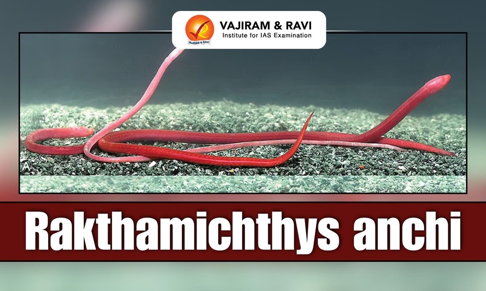
About Rakthamichthys anchi:
- It is a new species of phreatobitic synbranchid eel discovered in Assam.
- The name anchi is a Garo word meaning ‘blood’.
- The Rakthamichthys genus of phreatobitic (residing exclusively within the phreatic zone of groundwater aquifers) swamp eels (Synbranchidae) is endemic to India.
- It is now the second swamp eel of the genus to be discovered in the Northeast.
- Characteristics
- Its body carries no pigment at all.
- Its blood red colour, which gives the species its name, actually comes from blood vessels showing through its almost transparent skin.
What are Eels?
- Eels are elongated, slender fish, of which there are over 500 species characterized by elongate wormlike bodies.
- They lack scales, and their dorsal and anal fins run continuously around their tail.
- Habitat: Eels can be found in oceans across the globe, and many species can be found in freshwater habitats as well.
- Eels are primarily predatory fish with carnivorous diets. Some eel species are cannibalistic. Their diet typically consists of smaller fish, invertebrates, crustaceans etc.
Environment
Current Affairs
Aug. 3, 2026
Asiatic Wild Buffalo
The Chhattisgarh Forest Department is planning to translocate wild buffaloes from Assam and keep them in enclosures at the Pamed Wildlife Sanctuary, the Udanti Sitanadi Tiger Reserve and the Indravati Tiger Reserve (ITR).
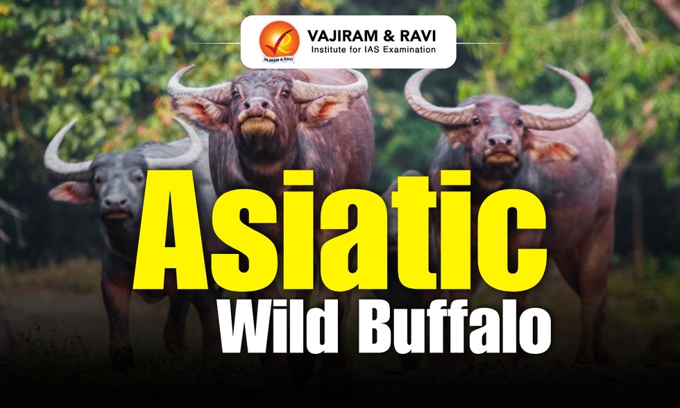
About Asiatic Wild Buffalo:
- It is the largest wild bovine in the world.
- Other Names: Asiatic buffalo, Wild water buffalo, Asian buffalo, Wild Asian buffalo
- Habitat: It includes swamps, flooded grasslands, other wetlands, alluvial plains, and densely vegetated river valleys.
- Distribution: It is found in Southern Nepal, eastern and central India, southern Bhutan and western Thailand.
- India is home to more than 90% of the global wild water buffalo population, with most found in Assam and smaller populations in Meghalaya, Chhattisgarh and Maharashtra’s Kolamarka forests.
- These are diurnal and nocturnal animals.
- Diet: These are herbivorous (folivorous, graminivorous) animals and regular diet includes aquatic plants, crops, grasses, herbs, leaves, and bark of trees.
- Threats: Parasites and diseases, hunting, loss of habitat, interbreeding of wild buffaloes with domestic.
- Conservation Status:
- IUCN Red List: Endangered
- Wildlife Protection Act, 1972: Schedule I
Environment
Current Affairs
Aug. 3, 2026
Egypt
Recently, an earthquake measuring magnitude 5.4 struck off Egypt.
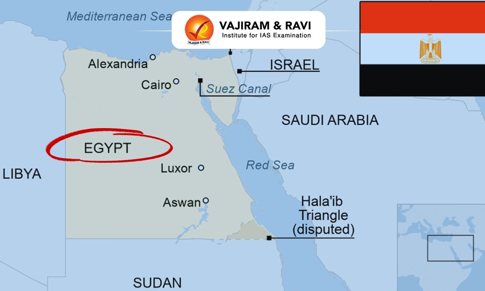
About Egypt:
- Location: It is located in the northeast corner of Africa to the southwest corner of Asia.
- The Sinai Peninsula of Egypt acts as the land bridge between Africa and Asia continents.
- Bordering Countries: It has land borders with Sudan (south), Libya (west), Israel and the Gaza Strip (northeast).
- Water Bodies: It has a coastline on the Mediterranean Sea (North) while the Red Sea and Gulf of Aqaba border it to the east.
- Capital City: Cairo
Geographical Features of Egypt:
- Climate: It has a tropical climate and has high temperatures throughout the year.
- Terrain: Its topography is marked by a striking contrast between its arid desert regions and the fertile Nile River Valley.
- Rivers: The Nile River, the longest river in the world, flows from south to north through Egypt.
- Highest Peak: Its highest point Mount Catherine.
- Natural Resources: Egypt’s natural resources include petroleum, natural gas, phosphates, and iron ore.
Geography
Current Affairs
Aug. 3, 2026
National Roll-out Plan for the Vessel Communication and Support System
Recently, the Union Department of Fisheries approved the national rollout of the Vessel Communication and Support System (VCSS) under the Pradhan Mantri Matsya Sampada Yojana.
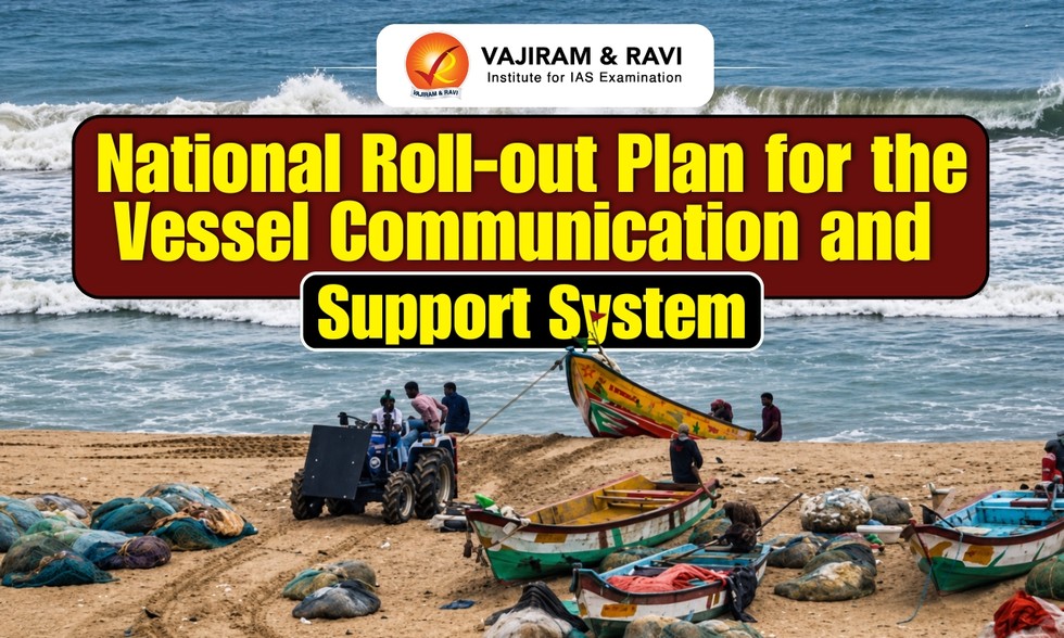
About National Roll-out Plan for the Vessel Communication and Support System
- It envisages installation of indigenously developed transponders on one lakh marine fishing vessels covering mechanized and motorized vessels of all 13 coastal States and UTs.
- It also focuses on establishment of the required earth station and associated communication infrastructure and development of the 'Nabhmitra' application in regional languages.
- The transponders are provided free of cost to eligible fishermen under the project.
- Financial Assistance: The project will be implemented on a 60:40 cost-sharing basis between the Centre and the States, while Union Territories will receive 100 per cent central assistance.
- Nodal Ministry: Ministry of Fisheries, Animal Husbandry & Dairying
- The Vessel Communication and Support System is a satellite based two-way communication system.
- It helps the fishers out at sea for sea-safety and security, provides alerts during adverse weather conditions, ‘No Fishing Zones’, International Maritime Boundary Line (IMBL) with geo-fencing and integration with the Nabhmitra App.
- It is being implemented with technical support of Indian Space Research Organization (ISRO).
- ISRO has also developed the ‘Nabhmitra’ application to provide real-time communication and support services to the marine fishing community.
- Nabhmitra’ application offers a range of features including periodic position reporting, two-way messaging, emergency and SOS alerts, automatic geo-fencing-based boundary crossing warnings, weather and cyclone advisories, emergency weather alerts, Potential Fishing Zone (PFZ) information, navigational assistance, and an e-Token/Trip Declaration system.
Science & Tech