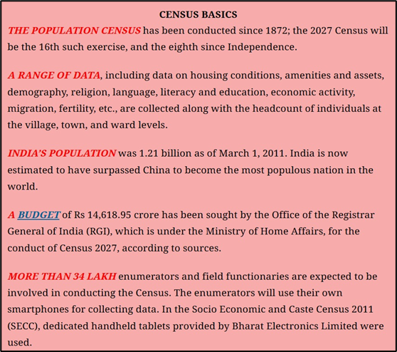
Why in news?
India’s 2027 Census will introduce several firsts, including digital enumeration, self-enumeration, and caste counting after 1931.
A major innovation will be geotagging of all buildings across the country. Each structure will be assigned precise GPS coordinates using mobile devices, ensuring accurate mapping of households and institutions. This will help remove duplication, improve coverage, and create a reliable spatial database to aid urban planning, infrastructure development, and better targeting of welfare schemes.
What’s in Today’s Article?
- About Geotagging
- Number of Buildings in India (Census 2011)
- How Geotagging Will Be Conducted in Census 2027
- Benefits of Geotagging in the Census
About Geotagging
- Geotagging is the process of marking a building’s exact latitude-longitude coordinates on a Geographic Information System (GIS) map.
- A GIS is a computer system that records, checks, and displays data linked to specific positions on Earth’s surface.
- Latitudes (horizontal lines) measure north-south distance from the equator, while longitudes (vertical lines) measure east-west distance from the prime meridian in Greenwich, UK.
- Together, these create a grid that allows any location to be uniquely identified.
- Through this system, geotagging assigns each building a precise locational identity that can be accurately pinpointed.
Number of Buildings in India (Census 2011)
- In Census 2011, a ‘Census House’ was defined as any building or part of a building with a separate main entrance, used as a distinct unit.
- Such houses could be occupied or vacant, and used for residential, non-residential, or mixed purposes.
- The Census recorded 330.84 million houses across India, of which 306.16 million were occupied and 24.67 million vacant.
- Rural areas accounted for 220.70 million houses, while 110.14 million were in urban areas.
How Geotagging Will Be Conducted in Census 2027
- Geotagging will take place during the Houselisting Operations (HLO), the first phase of the Census scheduled for April–September 2026.
- The second phase, Population Enumeration (will begin in February 2027) will record demographic, socioeconomic, and cultural details.
- In Ladakh, Jammu & Kashmir, Himachal Pradesh, and Uttarakhand, it will begin earlier in September 2026.
- Role of Enumerators
- Enumerators will visit all buildings within their assigned Houselisting Blocks (HLBs) — clearly demarcated areas in villages or town wards with notional maps.
- Using Digital Layout Mapping (DLM) and smartphone apps, they will switch on location services and geotag each building.
- The exercise will record the number of Census Houses and Households in each building.
- Buildings will be classified as residential, non-residential, partly residential, or landmarks.
- Definition of Household
- As per Census 2011, a household is a group of people normally living together and sharing meals from a common kitchen, unless prevented by work conditions.
Benefits of Geotagging in the Census
- Geotagging during the Census will provide accurate estimates of Census houses and households, ensuring better workload distribution for enumerators.
- Unlike earlier Censuses that relied on hand-drawn sketches, digital geotagging offers precision and efficiency.
- The government already uses geotagging on a smaller scale, such as for tracking houses built under Pradhan Mantri Awaas Yojana (PMAY) in rural and urban areas, demonstrating its practical usefulness.

