Why in News?
A powerful 7.7-magnitude earthquake struck Myanmar on March 28, causing buildings to collapse in Mandalay and bringing down a skyscraper under construction in Bangkok.
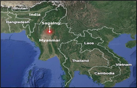
The quake, the strongest globally in two years, was followed by at least three aftershocks. The epicenter was 17.2 km from Mandalay at a shallow depth of 10 km.
What’s in Today’s Article?
- Cause of the Myanmar Earthquake
- Earthquake Frequency in Myanmar
- The Destructive Impact of Recent Earthquake
- Preparedness of Myanmar
Cause of the Myanmar Earthquake
- The Earth's lithosphere consists of tectonic plates that have been moving for billions of years.
- Earthquakes occur when these plates suddenly slip past each other, releasing stored energy as seismic waves, causing the ground to shake.
- Strike-Slip Faulting
- The Myanmar earthquake was caused by strike-slip faulting between the Indian and Eurasian plates, where the plates moved sideways against each other.
- The Sagaing Fault
- The earthquake occurred on the Sagaing Fault, a north-south fault line in Myanmar known for seismic activity.
- This fault marks the boundary between the Indian plate (moving north) and the Eurasian plate.
- The movement along this fault triggered the earthquake.
Earthquake Frequency in Myanmar
- Myanmar frequently experiences earthquakes due to the Sagaing Fault.
- Since 1900, at least six earthquakes of magnitude greater than 7 have occurred near this fault, according to USGS data.
- Notable Earthquakes
- January 1990 (Magnitude 7.0)
- February 1912 (Magnitude 7.9): Occurred just south of the epicenter of the recent quake.
- 2016 (Magnitude 6.9): Struck in roughly the same area.
- Major Earthquakes in the Last Century
- Over the past 100 years, Myanmar has witnessed 14 earthquakes of magnitude 6 or above.
- The 1839 Catastrophic Earthquake
- One of the worst earthquakes in the region occurred in 1839, estimated at magnitude 8.3.
- This event is considered the best recent analogue for the March 28, 2025, earthquake.
The Destructive Impact of Recent Earthquake
- Largest Quake in Decades
- The recent 7.7-magnitude earthquake was likely the strongest in Myanmar’s mainland in 75 years.
- Previous significant quakes caused casualties but were less severe.
- Shallow Depth Intensified Damage
- The quake occurred at a shallow depth of just 10 km, meaning the seismic shockwaves did not dissipate before reaching the surface.
- This resulted in stronger ground shaking and greater structural damage.
- Widespread Impact Beyond Epicenter
- Experts emphasized that seismic waves radiate from the entire fault line, not just the epicenter, affecting a much larger area.
Preparedness of Myanmar
- High Fatality and Economic Risk
- The USGS Earthquake Hazards Program estimated potential fatalities between 10,000 and 100,000, with economic losses possibly reaching 70% of Myanmar’s GDP.
- Infrastructure Not Built for Large Quakes
- Myanmar has not experienced a major earthquake in this region since 1956, leading to poor seismic preparedness.
- Buildings, especially in densely populated Mandalay, were not designed to withstand such powerful tremors.
- Geographic Factors
- Most earthquakes in Myanmar occur west of the Sagaing Fault, while this one struck the central region, which is less accustomed to high-magnitude quakes, further worsening the impact.

