Odisha Chief Minister Naveen Patnaik released a unique flood hazard atlas, which is expected to help the State manage floods more efficiently.
About:
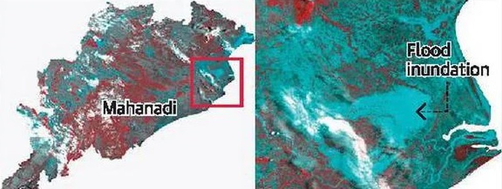
Time period covered: The flood hazard atlas system takes into account the flood inundation data captured through satellite imagery over the period from 2001 to 2018.
Bodies involved: The National Remote Sensing Centre (NRSC) of the Indian Space Research Organisation (ISRO), Hyderabad had taken the study on flood hazard zonation for Odisha.
Key findings:
About 8.96% (13.96 lakh hectares) of land in Odisha was affected by floods during 2001-2018.
Out of total flood-affected area (13.96 lakh hectares), about 2.81 lakh hectares of land falls under high (inundated 7-9 times) to very high (inundated 10-14 times) flood hazard categories.
Eight out of 30 districts such as Bhadrak, Kendrapara, Jagatsinghapur, Balasore, Puri, Jajpur, Khordha and Cuttack districts are more flood-affected districts. As high as 77% of Bhadrak and 70% of the Kendrapara district have been categorised as flood hazard.
Significance: It is expected to help the State manage floods more efficiently.
Dear Student,
You have still not entered your mailing address. Please enter the address where all the study materials will be sent to you. (If applicable).