The Ministry of Environment informed Parliament about the status of forest and tree cover in India.
About:
Assessment of forest and tree cover are done by the Forest Survey of India, whose findings are published in the India State of Forest Report (ISFR). The last report was published in 2017.
Total forest cover: A quarter of India’s geographical area (24.49 %) is under forest and tree cover.
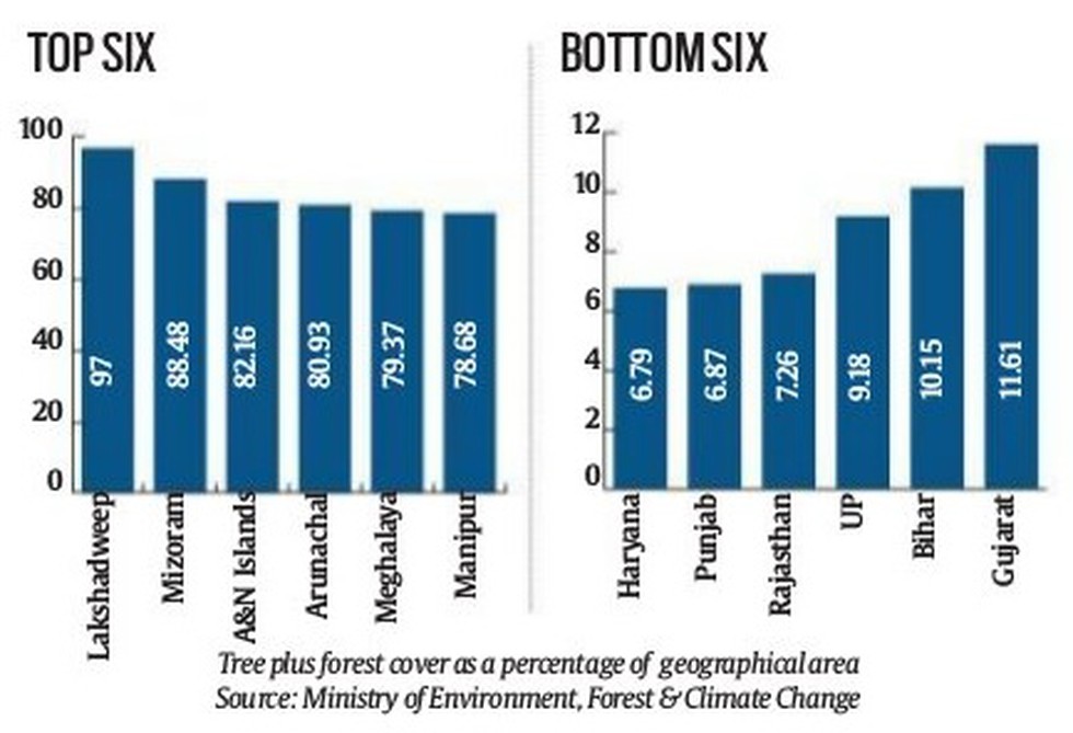
Lowest forest and tree cover (In terms of %):
The lowest forest and tree cover in the country is in Haryana, at 6.79 % of its geographical area.
Punjab follows with 6.87 %. Rajasthan’s forest and tree cover is over 7.26 % of its geographical area while Madhya Pradesh’s is 27.73 %.
Highest forest and tree cover (In terms of %):
At 97 %, the Union Territory of Lakshadweep is on top – its geographical area is only 30 square km.
Among the six states with the highest forest and tree cover, four are in the Northeast – Manipur, Arunachal Pradesh, Mizoram and Meghalaya.
Goa and Kerala are two other states with more than 50 % of their geographical area under forest and tree cover.
Highest forest and tree cover (In terms of area): In terms of geographical area, the highest tree and forest cover is in Madhya Pradesh, with 85,487 sq km.
Dear Student,
You have still not entered your mailing address. Please enter the address where all the study materials will be sent to you. (If applicable).