Thirteen stretches of rivers in Gujarat have been officially classified as polluted, with the Sabarmati emerging as the most contaminated, according to data tabled by the Union Government in the Lok Sabha recently.
About Sabarmati River:
It is a monsoon-fed, west-flowing river.
Course:
It originates in the Aravalli Mountain Range in the Udaipur district of the northern Indian state of Rajasthan.
The river is also called Wakal in its initial course.
The river flows in a southwesterly direction across Rajasthan and Gujarat.
It finally empties into the Gulf of Khambhat of the Arabian Sea.
It is about 371 km in length. In Gujarat, the river extends to a length of about 323 km, while in Rajasthan the river has a length of about 48 km.
The Sabarmati basin extends over an area of 21,674 sq.km with a maximum length and width of 300 km and 150 km.
The basin is bounded by Aravalli hills on the north and north-east, by the Rann of Kutch on the west, and by the Gulf of Khambhat on the south.
The major part of the basin is covered with agriculture, accounting for 68% of the total area.
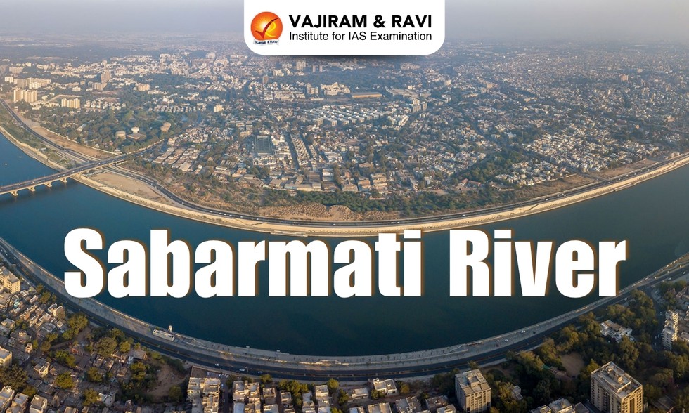
The banks of the Sabarmati River have Indian cities like Ahmedabad and Gandhinagar.
It flows north-south through Ahmedabad, bisecting the city into its western and eastern halves.
Major Tributaries: Wakal River, Harnav River, Hathmati River, Watrak River, and Madhumati
Dear Student,
You have still not entered your mailing address. Please enter the address where all the study materials will be sent to you. (If applicable).