About Strait of Gibraltar:
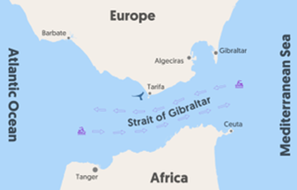
- It is a narrow waterway separating Europe from Africa and connecting the Mediterranean Sea to the Atlantic Ocean.
- Until the opening of the Suez Canal in 1869, the Strait of Gibraltar served as the only access point to the Mediterranean Sea.
- Borders: It is bordered by Spain and the British Overseas Territory of Gibraltar in the north, and by the African country of Morocco and the Spanish exclave of Ceuta in the south.
- It is about 58 km long and has a width of about 13 km at its narrowest point.
- Its depth ranges from 300 to 900 metres, and it forms a significant gap between the high plateau of Spain and the Atlas Mountains of Northern Africa.
- Geological studies have revealed that the strait was formed due to the northward movement of the African Plate towards the European Plate.
- It is one of the busiest waterways in the world. Approximately 300 ships cross the Strait every day, about one ship every 5 minutes.
- An important port located on the strait is the Moroccan port of Tanger-Med, near Tangier.
- Pillars of Heracles:
- The strait’s eastern end, located between the Rock of Gibraltar in the north and Mount Hacho or Jebel Moussa in the south, has a width of about 23 km.
- These two land features on the strait’s eastern extremity are known as the Pillars of Heracles.