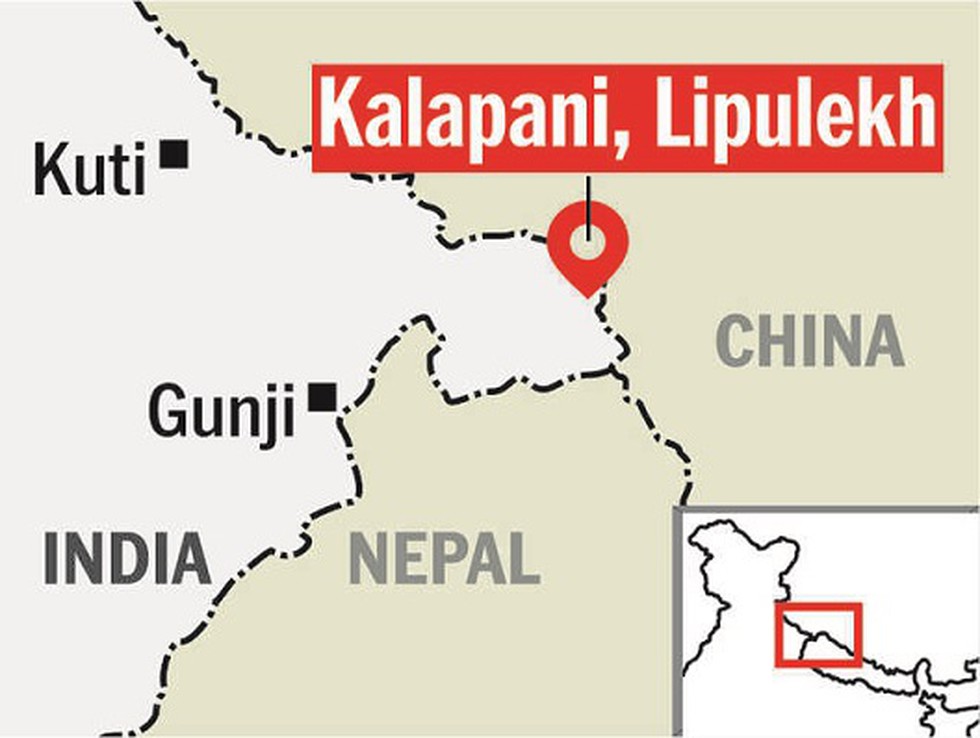
The Nepal government has decided it will release a new, updated political map which will include the disputed areas of Lipulekh, Kalapani and Limpiyadhura as part of Nepali territory.
About:
This comes after the Indian defence ministry recently inaugurated a link road to the China border that passes through Lipulekh. The Kalapani territory is an area under Indian administration as part of Pithoragarh district in the Uttarakhand state.
Following the road inauguration, the Nepal government released a press note stating that the eastern area from Mahakali River belongs to Nepal as per the Sugauli Treaty, 1816.
But the Indian government said that it had constructed the road in its own territory. A few days later, the Indian Army chief General M.M. Naravane accused Nepal of acting ‘at the behest of someone else,’ a thinly veiled reference to China.
Dear Student,
You have still not entered your mailing address. Please enter the address where all the study materials will be sent to you. (If applicable).