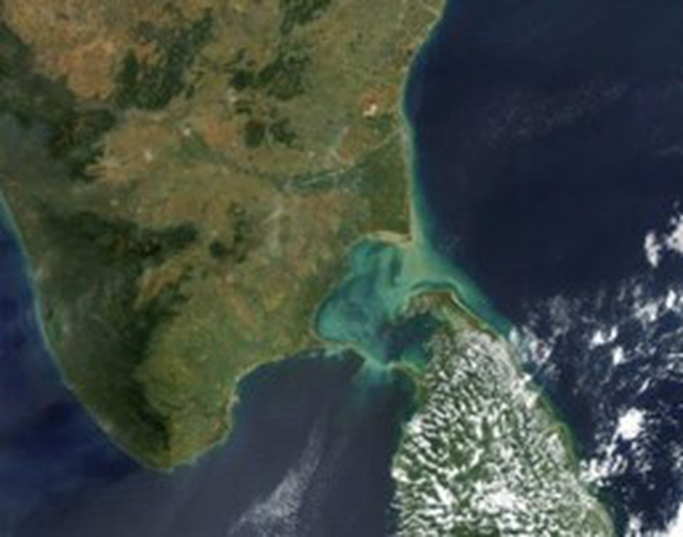
About Palk Strait:
- It is a strait that lies between the Tamil Nadu state of India and the island nation of Sri Lanka.
- The strait is named after Robert Palk, who was a governor of Madras Presidency (1755-1763) during the British Raj period.
- It is bounded on the south by Pamban Island (India), Adam’s (Rama’s) Bridge (a chain of shoals), the Gulf of Mannar, and Mannar Island (Sri Lanka).
- It connects the Bay of Bengal in the northeast with the Gulf of Mannar in the southwest.
- The southwestern portion of the strait is also called Palk Bay.
- The strait is 40 to 85 miles (64 to 137 km) wide, 85 miles long, and less than 330 feet (100 metres) deep.
- Several rivers flow into it, including the Vaigai River of Tamil Nadu.
- The port of Jaffna, the commercial centre for northern Sri Lanka, lies on the strait.
Key Facts about Adam’s Bridge:
- Adam's Bridge, also known as Rama's Bridge or Rama Setu, is a chain of limestone shoals, between Pamban Island, also known as Rameswaram Island, off the south-eastern coast of Tamil Nadu, India, and Mannar Island, off the north-western coast of Sri Lanka.
- Geological evidence suggests that this bridge is a former land connection between India and Sri Lanka.
- The bridge is 50 km long and separates the Gulf of Mannar (south-west) from the Palk Strait (northeast).
- Some of the sandbanks are dry, and the sea in the area is very shallow, being only 1 to 10 metres deep in places, which hinders navigation.
- Scientists believe Ram Setu is a natural structure formed due to tectonic movements and sand getting trapped in corals.
- The structure has significance in both Hindu and Muslim mythology. While the Hindus believe this is the bridge built by Lord Ram and his army to cross to Lanka and fight Ravan, as per Islamic legend, Adam used this bridge to reach Adam’s Peak in Sri Lanka, where he stood on one foot for 1,000 years in repentance.
