About Pyrocumulonimbus clouds:
- They occur only when there is an extremely hot wildfire — volcanic eruptions can also lead to the formation of pyrocumulonimbus clouds.
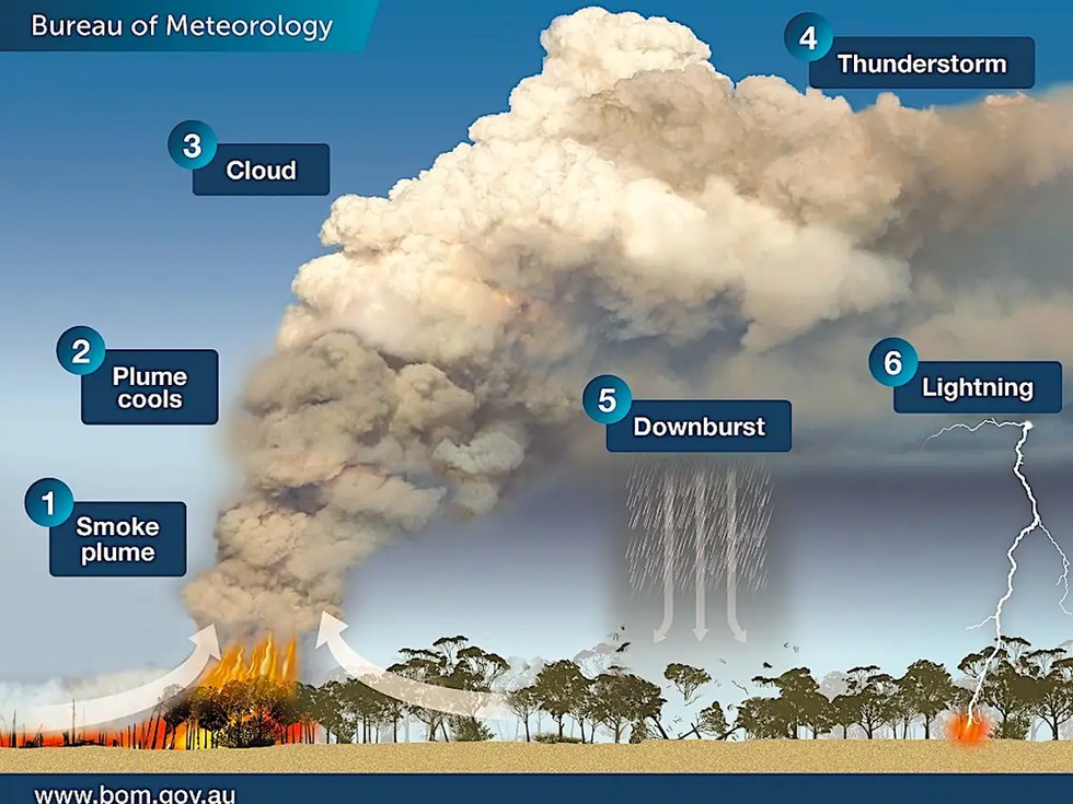
- Formation
- The intense heat from the fire warms the surrounding air which moves upward into the atmosphere.
- As this hot and very buoyant air — carrying water vapour, smoke, and ash — rises, it expands and cools down. Once it is cool enough, water vapour condenses on ash, forming a grey or brown cloud.
- At this stage, the cloud is known as a pyrocumulus cloud, also known as a ‘fire cloud’.
- If there is sufficient water vapour available and the upward movement of hot air intensifies, pyrocumulus clouds can evolve into a pyrocumulonimbus cloud.
- These clouds can reach heights of 50,000 feet and generate their own systems of thunderstorms.
- Although pyrocumulonimbus clouds can produce lighting, they do not generate much rain.
- As a result, they can spark new wildfires many kilometres away from the main blaze. These clouds can also trigger strong winds that can make the spread of the wildfire faster and unpredictable.
- Scientists believe that climate change could have a role to play in the increase of their frequency.
- Studies have shown that with temperatures soaring across the world, wildfires are becoming more common and intense.