Due to the huge success of seismic imaging technology that found an extra billion barrels of oil in the Gulf of Mexico, BP is looking to use its latest technology to Angola and Brazil.
About:
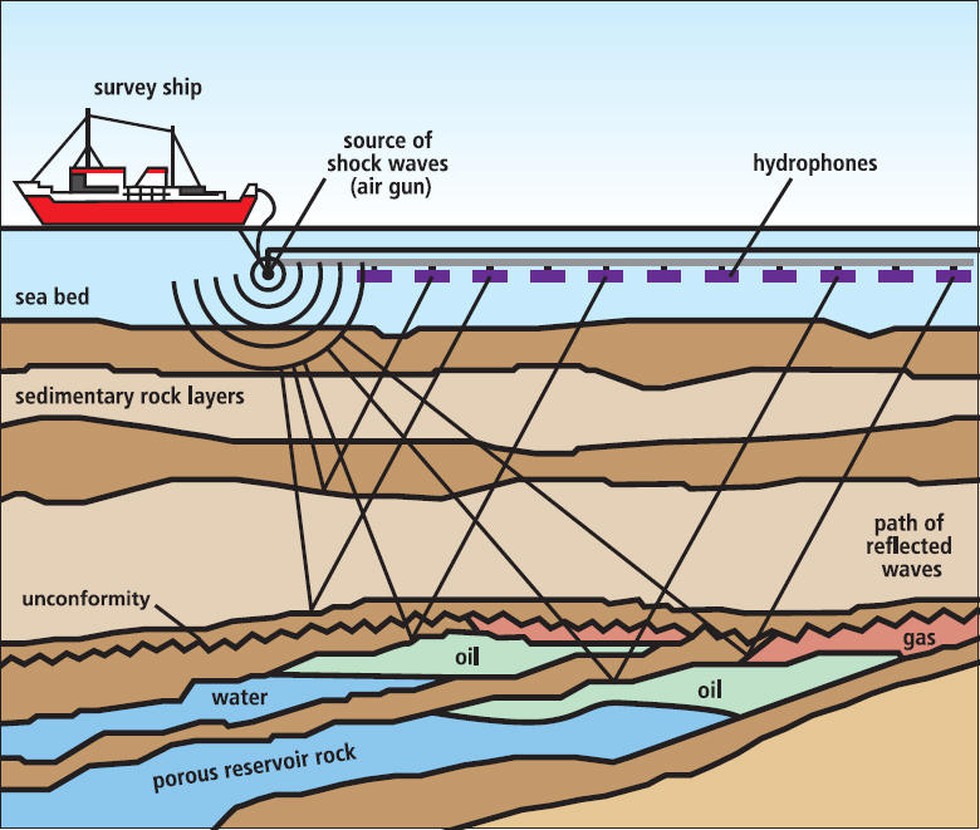
Seismic imaging is a tool that bounces sound waves off underground rock structures to reveal possible crude oil– and natural gas–bearing formations.
Working:
Seismologists use ultra-sensitive devices called geophones to record the sound waves as they echo within the earth.
By studying the echoes, petroleum geologists seek to calculate the depth and structures of buried geologic formations.
This analysis may help them identify oil- and gas-bearing reservoirs hidden beneath the earth's surface.
Recent discovery by BP: It used a software known as Full Waveform Inversion (FWI), which is run on a super computer and analyses reverberations of seismic sound waves to produce high-resolution 3D images of layers of rock under the sea bed, helping geologists locate oil and gas.
Significance:
The success of technology marks a major leap forward for deep water exploration — a costly business known for its low success rate and high risk.
It is an example of how technology is helping deep water make a comeback after a decade when the industry has focused on advances in onshore shale.
Dear Student,
You have still not entered your mailing address. Please enter the address where all the study materials will be sent to you. (If applicable).