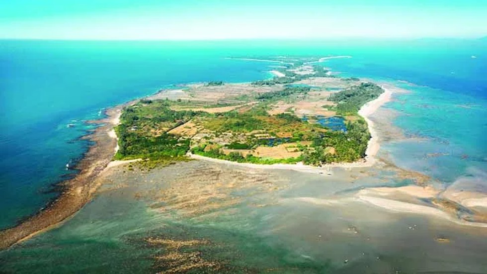
About St Martin’s Island:
- It is located in the northeastern region of the Bay of Bengal, close to the border between Bangladesh and Myanmar.
- It is nine kilometres away from the southern tip of Bangladesh’s Cox’s Bazar-Teknaf peninsula.
- Geography: It is mostly flat and sits at an elevation of 3.6 metres above the mean sea level. It is Bangladesh’s only coral island — there are reefs from 10-15 km to the west-northwest — and is also a breeding ground for sea turtles.
- What is the history of the island?
- The island was once part of the Teknaf peninsula (around 5,000 years ago) but gradually got submerged into the sea.
- Around 450 years ago, the southern suburbs of present-day St Martin’s Island resurfaced — the northern and rest of the parts of the island rose above sea level in the following 100 years.
- The Arab merchants were among the first ones to settle on the island. They began to arrive there in the 18th Century.
- The merchants initially named the island “Jazira” (meaning “the island” or “the peninsula”) and later changed it to “Narikel Jinjira” or “Coconut Island”.
- In 1900, British India annexed the island during a land survey. By then, some fishermen had settled on the island — they were either Bengali or from the Rakhine community (who were based in present-day Myanmar).
- During the British occupation, the island came to be known as St Martin’s Island, named after then Deputy Commissioner of Chittagong Martin.