About Teesta-V Hydropower Station:
- It is a 510 MW hydropower project located on the Teesta River basin in Gangtok district, Sikkim.
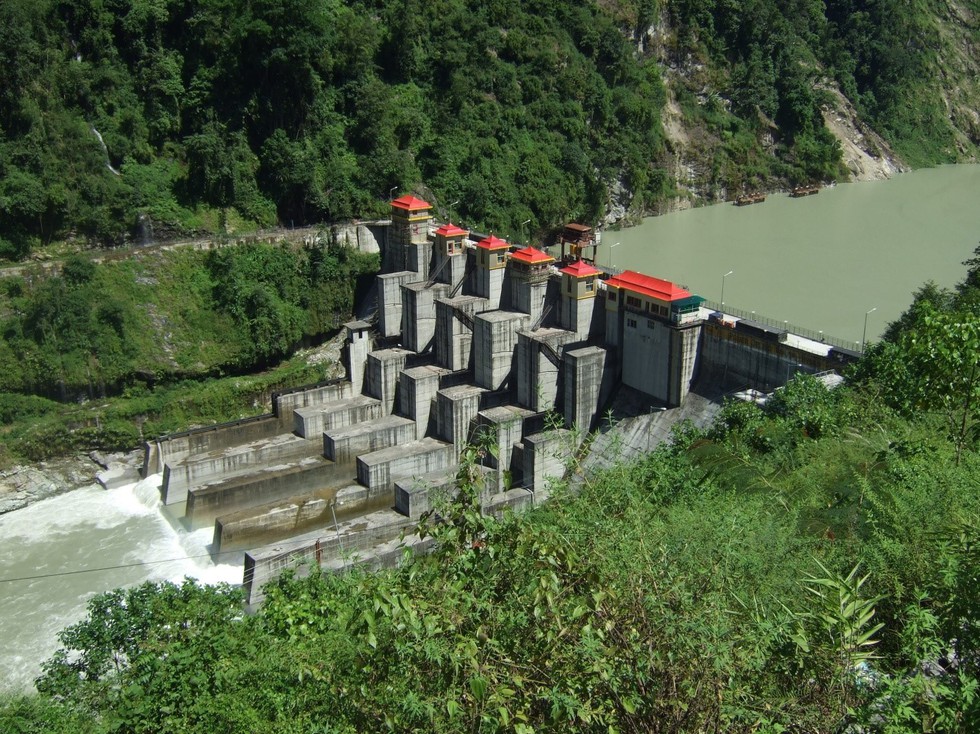
- This run-of-river project has an 88.6-meter high, 176.5-meter-long, concrete gravity dam impounding a regulating reservoir for daily power peaking.
- It has been developed in a single phase. The project construction commenced in 1999 and subsequently entered into commercial operation in 2008.
- The project is developed and owned bythe National Hydroelectric Power Corporation (NHPC).
Key Facts about Teesta River:
- It is a trans-Himalayan River flowing through the Indian states of Sikkim and West Bengal and Rangpur in Bangladesh.
- It is a tributary of Brahmaputra river.
- This river forms a boundary between Sikkim and West Bengal.
- Course:
- It rises in the Himalayasnear Chunthang in Sikkim (India), flows to the south, cutting a deep gorge through the Siwalik Hills east of Darjeeling (in West Bengal, India).
- It turns southeast to run through the Sivok Khola pass onto the plains of West Bengal.
- Originally, the river continued southward to empty directly into the upper Padma River (Ganges).
- About 1787, however, the river changed its course to flow eastward, crossing the Rangpur region of Bangladesh to join the Jamuna River (Brahmaputra).
- It has a total length of about 309 kilometers, and it drains an area of about 12,540 square kilometers.
- Major Tributaries:
- Left-bank Tributaries: Lachung Chhu, Chakung Chhu, Dik Chhu, Rani Khola, Rangpo Chhu.
- Right-bank Tributaries: Zemu Chhu, Rangyong Chhu, Rangit River.