What is a Cumulonimbus Cloud (Cb)?
- It is a heavy and dense cloudof considerable vertical extent in the form of a mountain or huge tower, often associated with heavy precipitation, lightning, and thunder.
- More commonly known as thunderclouds, cumulonimbus is the only cloud type that can produce hail, thunder and lightning.
- The base of the cloud is often flat, with a very dark wall-like feature hanging underneath, and may only lie a few hundred feet above the Earth's surface.
- The vertical extent of Cumulonimbus ranges from 3 km to rarely more than 15 km (10 000 – 50 000 ft).
- Cb forms when three conditions are met:
- There must be a deep layer of unstable air.
- The air must be warm and moist.
- A trigger mechanism must cause the warm, moist air to rise:
- Heating of the layer of air close to the surface.
- Rising ground forcing the air upwards (orographic uplift).
- A front forcing the air upwards.
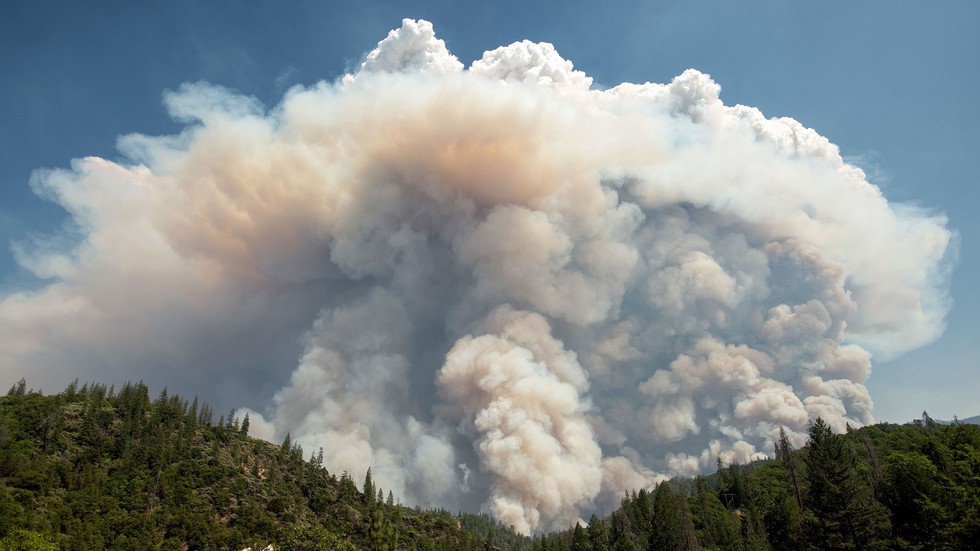
About Pyrocumulonimbus Clouds:
- They are thunderclouds created by intense heat from the Earth’s surface.
- They are formed similarly to cumulonimbus clouds, but the intense heat that results in the vigorous updraft comes from fire, either large wildfires or volcanic eruptions.
- So it is, for this reason, the prefix ‘pyro’ is used – meaning fire in Greek.
- They look much darker than typical clouds because of their large amounts of smoke and ash.
- Pyrocumulonimbus clouds are thought to be responsible for several aerosol pollutants (such as smoke and ash) trapped in the stratosphere and upper atmosphere.
- And sometimes, lightning strikes generated from them even can ignite additional fires.