A huge city hidden by the luxuriant vegetation of the Amazon rainforest was recently discovered in Ecuador by a LiDAR survey.
About LiDAR:
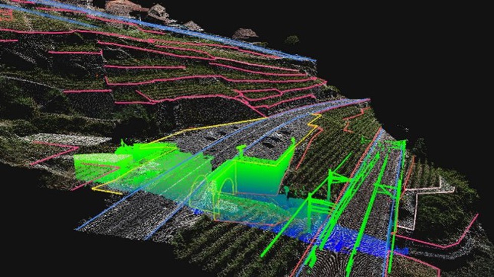
Lidar, which stands for Light Detection and Ranging, is a remote sensing method that uses lightin the form of a pulsed laser to measure ranges (variable distances) to the Earth.
These light pulses—combined with other data recorded by the airborne system — generate precise, three-dimensional information about the shape of the Earth and its surface characteristics.
A lidar instrument principally consists of a laser, a scanner, and a specialized GPS receiver.
Airplanes and helicopters are the mostcommonly used platforms for acquiring lidar data over broad areas.
How Does it Work?
A LiDAR system calculates how long it takes for beams of light to hit an object or surface and reflect back to the laser scanner.
The distance is then calculated using the velocity of light. These are known as ‘Time of Flight’ measurements.
Two types of lidar are topographic and bathymetric.
Topographic lidartypically uses a near-infrared laser to map the land, while bathymetric lidar uses water-penetrating green light to also measure seafloor and riverbed elevations.
Lidar systems allow scientists and mapping professionals to examine both natural and man-made environments with accuracy, precision, and flexibility.
It is used in a wide range of land management and planning efforts, including hazard assessment (including lava flows, landslides, tsunamis, and floods), forestry, agriculture, geologic mapping, and watershed and river surveys.
What is the difference between Radar and LiDAR?
LiDAR works in a similar way to Radar and Sonar yet uses light waves from a laser, instead of radio or sound waves.
Dear Student,
You have still not entered your mailing address. Please enter the address where all the study materials will be sent to you. (If applicable).