Wadia Institute of Himalayan Geology (WIHG), an autonomous institute under the Department of Science &Technology, Govt. of India, studied rivers in Ladakh Himalaya, bringing out 35 thousand-year history of river erosion and identified hotspots of erosion and wide valleys that act a buffer zones.
About:
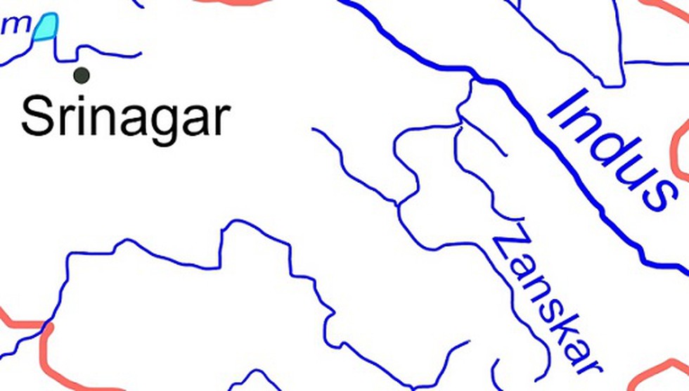
The Ladakh Himalaya forms a high altitude desert between Greater Himalayan ranges and Karakoram Ranges. The Indus and its tributaries are major rivers flowing through the terrain.
In the study published, Zanskar catchment was explored by WIHG team to understand the landform evolution in transitional climatic zone.
Zanskar River?
The Zanskar River is a north-flowing tributary of the Indus.
It is one of the largest tributaries of the upper Indus catchment, draining orthogonally through highly deformed Zanskar ranges.
Two prominent tributaries of Zanskar River are the Doda and TsrapLingti Chu, which confluence at Padam village in the upper valley to form the Zanskar River.
Dear Student,
You have still not entered your mailing address. Please enter the address where all the study materials will be sent to you. (If applicable).